Industrial Inspection
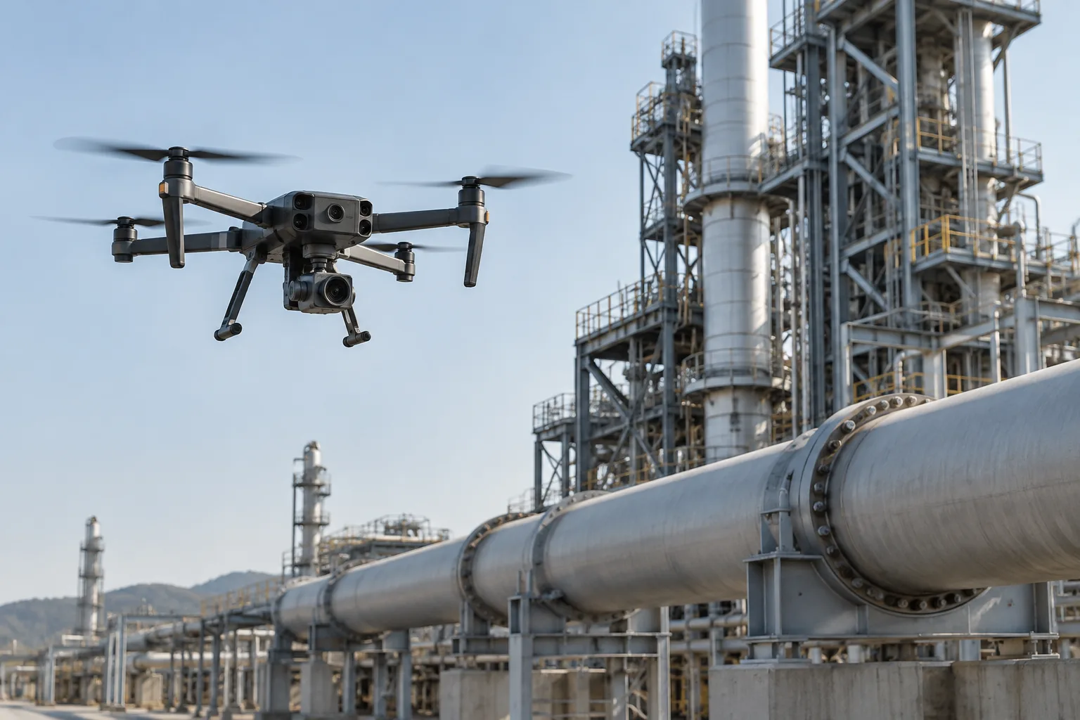
Drone Solutions for Industrial Inspection
Inspect critical infrastructure faster, safer and more efficiently with reliable UAV platforms, professional payloads and flexible mission configurations.
Long-Range Operation
Platforms and control links selected for the area a mission must cover.
HD + Thermal Payloads
RGB, zoom and thermal options for the condition you are looking for.
Automated Missions
Waypoint flight for consistent, repeatable inspection passes.
Custom Integration
Payload, airframe and system configuration built around the mission.
The Challenge
Traditional Inspection Is Time-Consuming, Risky and Costly
Assessing elevated, remote or hard-to-reach assets by hand brings real constraints to industrial inspection work.
Safety Risks
People are exposed to heights, live infrastructure and hazardous positions to reach what needs checking.
Long Inspection Cycles
Access planning and on-site setup make each pass slow to arrange and slow to complete.
High Labor & Equipment Costs
Crews, access equipment and downtime add up quickly across a large site.
Inconsistent Inspection Data
Different angles and viewpoints between passes make results hard to compare and review.
Our Solution
A Faster, Safer Way to Inspect Critical Assets
The right drone platform, payload and mission workflow combine into reliable inspection data across different industrial environments.
Automated Flight
Pre-programmed routes improve mission repeatability and inspection consistency.
High-Resolution Imaging
Capture detailed visual data from elevated, remote and hard-to-access areas.
Thermal Inspection
Identify abnormal heat signatures and potential equipment faults.
Remote Operation
Reduce unnecessary on-site access while maintaining useful inspection coverage.
Where It Can Be Used
Our platforms are configured around the payload, range, operating environment and data requirements of each inspection mission.
Power Line Inspection
Transmission towers, conductors, insulators and substations.
Solar Farm Inspection
Solar panels, thermal hotspots and performance abnormalities.
Pipeline Inspection
Long-distance pipelines and remote infrastructure.
Bridge Inspection
Hard-to-reach structural areas and elevated infrastructure.
Industrial Facility Inspection
Factories, tanks, chimneys and large industrial equipment.
Recommended UAV Platforms for Industrial Inspection
The cards below are reference placeholders for inspection-configured platforms, pending verified product data. They illustrate how a platform and its payloads are matched to a mission, and will be replaced with real products. Browse the current full range on the product catalog.
Placeholder · Replace with real product
Inspection UAV — Reference A
Multi-rotor platform configured for thermal and zoom inspection missions.
Flight time 45–60 min
Max payload ~4 kg
Control range up to 20–50 km
Wind resistance up to 12 m/s
Operating temp −20 °C to +50 °C
Positioning GNSS / RTK
Payloads Zoom + Thermal
Placeholder · Replace with real product
Inspection UAV — Reference B
Long-range rotorcraft configured for pipeline and corridor missions.
Flight time 50–60 min
Max payload ~3 kg
Control range long range
Wind resistance up to 10 m/s
Operating temp −20 °C to +50 °C
Positioning GNSS / RTK
Payloads RGB + Zoom
Placeholder · Replace with real product
Inspection UAV — Reference C
Compact platform configured for facility and confined-area inspection.
Flight time 30–50 min
Max payload ~2 kg
Control range moderate
Wind resistance up to 8 m/s
Operating temp −10 °C to +45 °C
Positioning RTK
Payloads RGB + Thermal
Configure the UAV Around Your Mission
Different inspection missions require different combinations of endurance, payload, communication range and sensing equipment. The table below is a reference planning guide, pending verified product data.
| Mission | Recommended Payload | Flight Time | Control Range | Positioning | Flight Mode |
|---|---|---|---|---|---|
| Power Line | Zoom + Thermal | 45–60 min | 20–50 km | RTK | Waypoint / Manual |
| Solar Farm | RGB + Thermal | 45–60 min | 10–30 km | RTK | Automated Waypoint |
| Pipeline | RGB + Zoom | 50–60 min | Long Range | GNSS / RTK | Waypoint |
| Industrial Facility | Zoom + Thermal | 30–50 min | Short / Medium | RTK | Manual / Assisted |
Reference ranges for mission planning. Final values depend on the selected platform and verified product specifications.
From Mission Planning to Inspection Data
A clear workflow turns a site into usable inspection records.
01
Plan Mission
Define the flight area, target assets and inspection points.
02
Deploy Drone
Use autonomous or manual operation depending on the site.
03
Capture Data
Collect RGB, zoom, thermal or other payload data.
04
Review & Analyze
Process and review inspection imagery and recorded data.
05
Generate Results
Turn collected information into useful inspection records.
Typical Mission Example
Solar Farm Inspection
A typical deployment profile, shown to illustrate how the platform, payload and flight mode come together on a real mission. It is not a specific customer case.
Application
Solar farm inspection
Payload
RGB + Thermal camera
Flight Mode
Automated waypoint mission
Mission Objective
Identify panel hotspots and abnormal modules while reducing unnecessary manual inspection.
Flexible Payload Integration
NEXA platforms can carry the payloads a mission needs. Send us your requirements and we will evaluate the fit.
EO / IR Camera
Thermal Camera
Zoom Camera
LiDAR
Multispectral Camera
Spotlight
Gas Detector
Custom Sensor
Built Around Your Mission
The UAV platform can be configured based on payload weight, endurance, flight range, operating environment and mission requirements.
Custom Payload Integration
Integrate RGB, thermal, LiDAR, multispectral or customer-specific payloads.
OEM / ODM Support
Support for airframe, payload, communication and system configuration.
Mission-Specific Configuration
Match payload, range, endurance and operating environment to the mission.
Testing & Validation
Flight testing and system validation can be completed before delivery.
Frequently Asked Questions
Common questions about choosing and configuring an inspection platform.
Can the drone carry our own camera or sensor?
Yes, depending on payload weight, mounting, power supply, data interface and aircraft configuration. Send us the payload specifications for evaluation.
Can flight range be customized?
Range depends on the aircraft platform, communication system, payload, mission profile and the local operating environment.
Do you support autonomous inspection missions?
Supported functions can include waypoint missions, planned routes and other automated flight modes depending on the selected platform.
Can you provide OEM / ODM solutions?
Yes. OEM and ODM scope can cover platform configuration, payload integration, branding, accessories and selected system-level customization.
What information do you need to recommend a UAV?
Payload type and weight, required range, target flight time, operating environment, mission type and expected quantity are the most useful starting points.
Can the aircraft configuration be customized for different industries?
Yes. The platform can be configured based on payload weight, endurance, flight range, operating environment and mission requirements for different industries.
Tell Us About Your Mission
Share your payload, required range, endurance, operating environment and mission type. Our team can recommend a suitable UAV platform or discuss a customized configuration.